GPS and GIS... whats it all about... can it work in Malaysia?? GIS Maps?? Part 2
Well Part 1 covers the basics of GPS. Let’s go into more details of the link with GIS…
OK… can GPS be used in mapping?? Well.. it was initially used for navigation and many mappers/surveyors were skeptical of its accuracy. Mapping accurately used to be a very tiresome process… we used to make maps from ‘control points’ and their position is based on bearings and distances from that ‘control point’. Any object on the earths surface is mapped like this… even today.
These are some of the other mapping / positional systems or practice used:
- Landmarks: Only work in local area. Subject to movement or destruction by environmental factors.
- Dead Reckoning: Very complicated. Accuracy depends on measurement tools which are usually relatively crude. Errors accumulate quickly.
- Celestial: Complicated. Only works at night in good weather. Limited precision.
- OMEGA: Based on relatively few radio direction beacons. Accuracy limited and subject to radio interference.
- LORAN: Limited coverage (mostly coastal). Accuracy variable, affected by geographic situation. Easy to jam or disturb.
- SatNav: Based on low-frequency doppler measurements so it's sensitive to small movements at receiver. Few satellites so updates are infrequent.
Step 1 – Lets say based on the timing of the clock between GPS satellite and receiver (see Part 1)… we get a measurement of 20,000 KM. This is from the first satellite. So… now we can make a sphere based on radius of 20,000 KM.
Step 2 - We then get a distance of the second satellite and find out its 21,000 KM away. We create a second sphere based on 21,000 KM radius now.
Step 3 - With the 2 spheres we can position our location where the 2 spheres ‘intersect’.
Step 4 – With the third satellite we get a position of 20,000 KM. We create a third sphere based on 20,000 KM radius now. This will make our position more accurate based on the intersection of this new third sphere.
Step 5 – So by calculating the intersection of 3 satellites and its spheres… we can derive the latitude and longitude of our position in space.
Thats how we can derive exact positions on the earths surface... whoever thought about this is a genius... :D

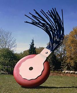
Claes Oldenburg and Coosje van Bruggen
Typewriter Eraser, Scale X, 1999
National Gallery of Art, Washington
Gift of The Morris and Gwendolyn Cafritz Foundation


0 Comments:
Post a Comment
Subscribe to Post Comments [Atom]
<< Home